Saturday, August 31, 2013
Friday, August 30, 2013
Thursday, August 29, 2013
Wednesday, August 28, 2013
Tuesday, August 27, 2013
Monday, August 26, 2013
Sunday, August 25, 2013
Saturday, August 24, 2013
Friday, August 23, 2013
Thursday, August 22, 2013
Wednesday, August 21, 2013
Tuesday, August 20, 2013
Monday, August 19, 2013
Saturday, August 17, 2013
Friday, August 16, 2013
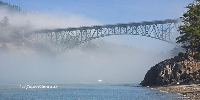
Deception Pass boat tour, part 3
The Deception Pass Bridge was completed in the summer of 1935.
The smaller span is 511 feet long, connecting Pass Island with Fidalgo Island. The tidal flow through Canoe Pass is less dangerous than the larger Deception Pass but it is a blind corner and is not used by power boats. It received its name from Indians using it in their canoes.
The larger span is 921 feet long, connecting Pass Island and Whidbey Island. Deception Pass is known for its turbulent tidal flow. During peak tidal flow, treacherous whirlpools can be seen from the bridge.
Thursday, August 15, 2013
Deception Pass boat tour, part 2
 An interesting stop on the boat tour is to look at the remains of a state prison camp on the cliffs of Fidalgo Island. The prison camp was in operation from 1910 t0 1914. About 40 prisoners on an honors release program from the Walla Walla prison were housed nearby and worked the quarry. The quarried rock was taken by barge to be used on the Seattle waterfront.
The quarry was dismantled in 1924 and the lumber used to form ferry slips and cottages. The cave was tempting to adventurers and after a fatal fall, the entrance was barred.
This photo was shown on the tour, giving an idea of the quarry in operation. The quarry was long before the Deception Pass bridge was built in the 1930s. You can find out more information on the prison quarry here.
Wednesday, August 14, 2013
Deception Pass boat tour, part 1
I recently went on the hour long Deception Pass Tours boat trip. Deception Pass State Park is the most visited state park in Washington. Some three million vehicles go over the bridge each year, traveling between Whidbey and Fidalgo Islands.
It is also a popular spot for fishing. As we approached the bridge, we could see fishing boats in "the hole," a deep water area where salmon (hopefully) congregate. Our tour guide said the every-other-year run of humpies would be starting soon.
The tour begins at Cornet Bay at the north end of Whidbey Island. More photos tomorrow.
Tuesday, August 13, 2013
Monday, August 12, 2013
Sunday, August 11, 2013
Saturday, August 10, 2013
Friday, August 9, 2013
Thursday, August 8, 2013
Washington Pass Overlook, North Cascades Highway
The Washington Pass Overlook is about five miles east of Rainy Pass. This view shows Highway 20 as it approaches the pass from the east.
To the south are Liberty Bell Mountain (right) and the Early Winter Spires (left).
Notice the cars on the road cut at the lower third of the photo, to the left. They give you an idea of the size of this view.
And the view to the northeast at the Overlook.
To the south are Liberty Bell Mountain (right) and the Early Winter Spires (left).
Notice the cars on the road cut at the lower third of the photo, to the left. They give you an idea of the size of this view.
And the view to the northeast at the Overlook.
Wednesday, August 7, 2013
Tuesday, August 6, 2013
Sunday, August 4, 2013
Subscribe to:
Comments (Atom)


