
Photographic images near Whidbey Island, Washington, U.S.A.
Wednesday, February 29, 2012
Growlers over Mt. Baker
Monday, February 27, 2012
February Sunrise

Sunday, February 26, 2012

Friday, February 24, 2012
Whidbey Island Storm

Thursday, February 23, 2012
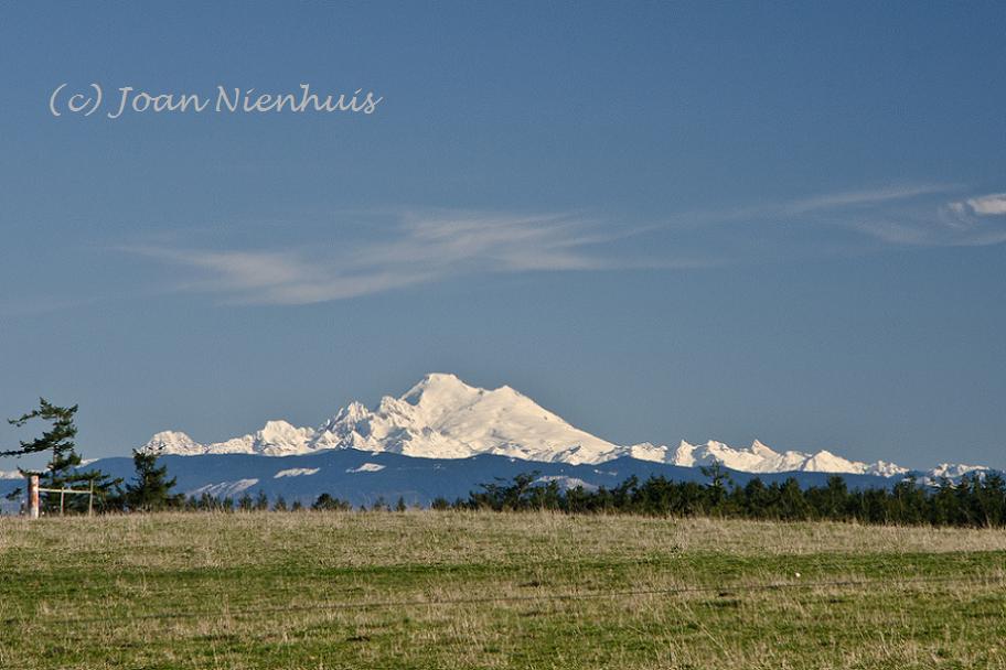
Mt. Baker from Whidbey Island
Wednesday, February 22, 2012
Using ICE for Panorama Stitching
Who doesn't like a free program to do amazing feats with your digital images? Today I tried a free download from Microsoft, ICE, or Image Composite Editor. Here is the result of combining ten JPEG images.
 I left the image as it was finished in ICE, dust spots and all. I did crop slightly, in ICE, but see now I left a bit of error cropping at either end.
The positives about this program: it was fast, much faster than, say, Elements. The quality for web viewing is great. For free, it is wonderful and allows anyone to try making a panorama.
The negatives: the resulting file is much smaller than would be produced in Elements. The end file was 5.11 MB, smaller than each of the ten JPEGs. If you need the several hundred MB images that Elements produces, this program will not work for you.
So, get out your camera, put it on a tripod, take a series of overlapping images, load them into ICE, and you have your panorama. You can even go further and make an interactive 360 view using Microsoft Silverlight - but that is for another day.
(Note: the above image has been greatly reduced in Paint to an 82 KB file. I do that so no one is tempted to "take" the image and use it.)
Tuesday, February 21, 2012
Cascade Mountains from Whidbey Island
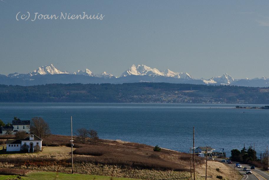
I grew up on a farm walking distance from here. As a child, I would often come to this hill and contemplate this inspiring view.
Monday, February 20, 2012
Olympics from Libbey Beach

Saturday, February 18, 2012
Olympic Mountains Sunset Panorama

Monday, February 13, 2012
Coupeville Statues

Coupeville was founded in 1852 by Captain Thomas Coupe and is the second oldest town in
Washington state. Coupeville was officially incorporated on April 20, 1910.
These statues are in Cooks Corner Park at 9th and Main Street.
Saturday, February 11, 2012
Perego's Lake, Whidbey Island

This is a recent view at dusk from Ft. Ebey State Park on Whidbey Island. The Cascade Mountains are in the distance. The barracks at Camp Casey can be seen in the distance. Near is Perego's Lake, just north of Ebey's Landing. This view point is just a short walk from the parking area. The trail is quite level.
Friday, February 10, 2012
Sunny Day View

Even on overcast days we can remember the view. This was the scene a few days ago. In the distance are the North Cascade Mountains. In the foreground is Oak Harbor.
Thursday, February 9, 2012
It's Raining Again

We had a dry January but I think we are making up for it today.

We do need the rain. And if we didn't have the rain we wouldn't have the green.
Wednesday, February 8, 2012
Winter Farm on Whidbey Island

A few acres on Whidbey Island... This is a recent view from the west side of Whidbey Island, just west of Oak Harbor. In the distance are the Olympic Mountains.

This was the view from nearly the same place about a year ago.
Can you imagine, going out in the morning to feed the horse and having a view like this?
Monday, February 6, 2012
Olympic Sunset

This time of the year the sun sets behind the Olympic Mountains. These people are enjoying the sunset from Fort Ebey State Park.

There has been a high pressure system over the Pacific Northwest and on this evening, the sea was particularly calm.

Fort Ebey State Park, on the west side of Whidbey Island, is a great place to watch winter sunsets. The hike to the cliff is about a hundred yards from the parking area. The views are spectacular and the access is easy.
Saturday, February 4, 2012
Mt. Rainier Dusk

Finally, after seems like months of clouds, we had a sunny day. I went out to Ft. Ebey State Park on the west side of Whidbey Island to capture Mt. Rainier at dusk.

I was not disappointed. Even after the sun had set behind the Olympic Mountains to the southwest, its light still graced the grand mountain to the south.
The location for this photo is a very short hike from the gun mount parking lot. The trail, though narrow, is quite level. The views are amazing: Mt. Rainier, the Olympic Mountains, the Salish Sea. I hope to see you there next time.
Friday, February 3, 2012
Sunlit Cascades

Thursday, February 2, 2012
Jet Stream Flower

There are times when the Jet Stream makes itself evident. On this day, it was coming out of the northwest, bring down cold Canadian air.
Wednesday, February 1, 2012
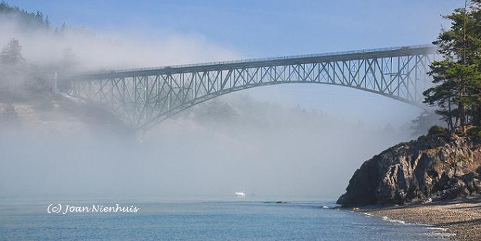
Sunset from Deception Pass Bridge

Subscribe to:
Posts (Atom)